
Looking Up San Francisco Neighbors
A block-level neighbor lookup works by comparing several official layers around one known address. PIM supplies the parcel geometry and APNs. The secured roll can add title owners and mailing addresses through the counter or paid data route. The Recorder index can connect an APN to deeds and liens. A historical street directory can show a listed occupant for an earlier year. The Neighborhood Groups Map can identify public civic organizations overlapping the parcel, but it does not expose member lists.
| Source | What It Shows About a San Francisco Block | Access |
|---|---|---|
| PIM parcel map | Adjacent APNs, addresses, zoning, history, permits, complaints, and districts | Free map and report |
| Secured assessment roll | Title-linked owner, mailing address, values, and exemptions | Assessor-Recorder counter or paid roll data |
| Recorder index | Deed parties and instruments tied to APN or legal description | Free metadata from 1990; copies and older channels |
| Voter file | Residence or precinct fields in approved data | Own-record tool or purpose-limited request |
| 1940 House and Street Directory | Historical address-to-listed-occupant clues | SF History Center print, microfilm, or online |
| Neighborhood Groups Map | Public organization or contact overlapping an address | SF Planning map; no member directory |
Read each row as a different type of evidence. A title owner is not automatically an occupant. A directory entry is not a current status. A civic organization’s public contact is not a private roster. The best neighbor research records those distinctions beside each result.
Clicking Adjacent San Francisco Parcels
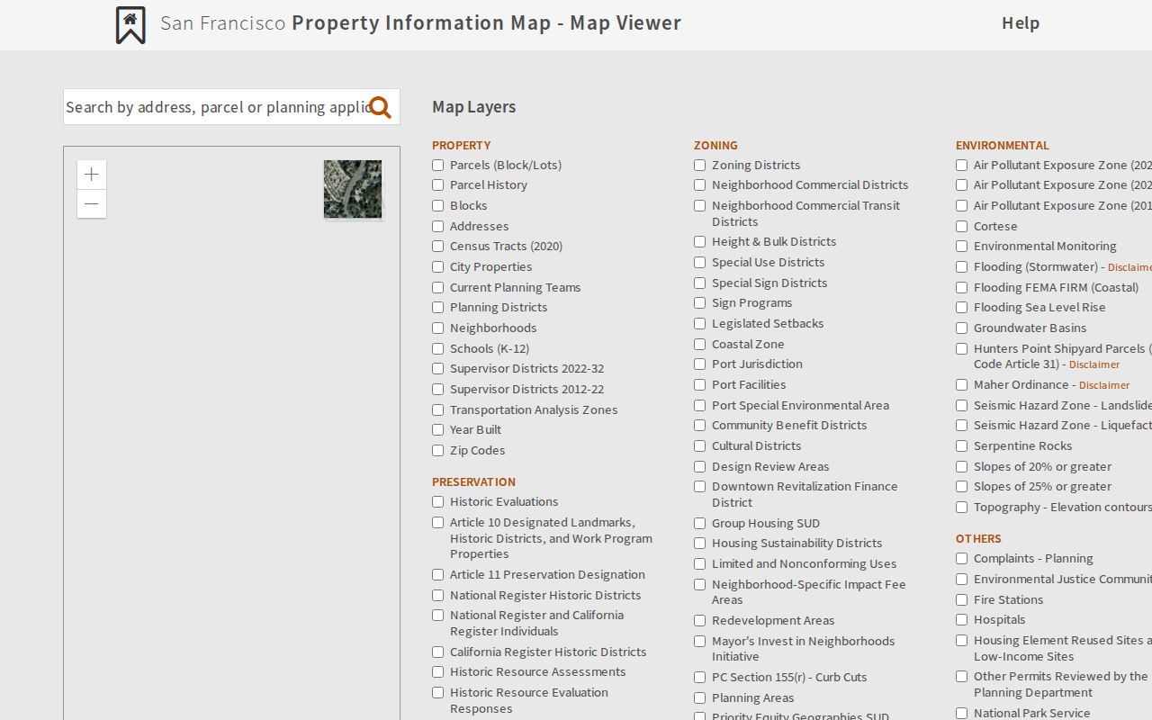
The PIM map has no documented public radius or buffer export of neighbors. The reliable method is a controlled parcel walk. Start with the target address, enable Parcels, Blocks, and Addresses, zoom to the polygons, and click each adjoining parcel. Print the map and selected report tabs so the comparison is repeatable. The ZIP and Neighborhood layers add context, while Measure Distance and Map Legend help orient a narrow block or irregular edge.
- Search the target address in PIM’s map and select the official matched site.
- Save the target situs, block and lot, APN, ZIP, neighborhood, and district fields.
- Click the parcels that share a side or corner, then compare Property, Zoning, Historic Preservation, permits, complaints, and Map tabs.
- Keep the selected reports together and mark which facts came from the map, the roll, or a recorded instrument.
The flow is simple: address → canonical parcel → adjoining APNs → title or instrument check → historical or civic context. It is a block comparison, not a resident export.
The official PIM map shows San Francisco parcels, blocks, addresses, and nearby property context.
What PIM Shows About a San Francisco Parcel
A neighboring parcel report can expose zoning, height and bulk controls, environmental and historic designations, planning applications, building and other permits, complaints, appeals, parcel history, year built, census tract, supervisor district, neighborhood, services, transportation, police district, and ZIP layers. That breadth makes PIM useful for understanding why two nearby addresses have different records or different custodians.
The map still does not show a general public owner field. An Assessor Summary is not the assessment roll. For owner evidence, use the Assessor-Recorder counter or paid data product. For title history, carry the APN or legal description into the Recorder Public Index. For building activity, use DBI’s address, block-and-lot, application, permit, or complaint inquiry and its nightly DataSF dataset. The parcel report is the bridge, not the final people record.
Parcel rule. A map can show what touches the target parcel. It cannot infer that the person named in one report lives in the neighboring building.
San Francisco Block Owners Need a Title Check
Current ownership research has two steps. First, obtain the owner and mailing-versus-situs fields from the secured assessment roll, counter, or paid data product. Second, inspect the Recorder index for the deed or instrument that supports the title clue. The Recorder result may list APN, document number and date, page count, title or description, correction or reference indicators, indexed parties, grantor or grantee role, and a copy link. A full document may add legal description, transfer-tax statement, signatures, notary, and recording stamp.
The Recorder’s verified online boundary is 1990-present. City Hall Room 190 terminals, microfilm, microfiche, older deed books, and SFPL microfilm provide older routes. The current mail form and fee schedule control copies. Keep a neighbor’s mailing address as a contact clue only. It does not establish present occupancy, household size, or the identity of every person using the parcel.
Voters Cannot Be Browsed by San Francisco Street
California My Voter Status is an authenticated own-record service. It asks for first name, last name, date of birth, and conditional driver license or ID and last-four-SSN fields. A match can show registration status and address, party and language preference, polling place, election information, and vote-by-mail or provisional status. That does not authorize a neighbor to search an unidentified block.
Voter-file requests are limited by Elections Code §§2188 and 2194 and 2 CCR §§19001-19013. A request needs a qualified election, political, scholarly, journalistic, or governmental purpose, complete identifying details, documentation, and protection against unauthorized use. Regulations say an unidentified set of people on a street is not a specific-voter request. Safe at Home and confidential voters are excluded. Inactive status also does not prove the date a person moved.
San Francisco Neighborhood Groups Around a Parcel
The SF Planning Neighborhood Groups Map is the authoritative discovery layer for public organizations that overlap an address. It can point to a civic group or contact route without promising a member directory. SFPL Web Archives separately preserves a San Francisco Neighborhood Associations collection, which can retain public organization pages after a site changes. These sources are useful for community history, meeting context, and public contact information.
Neighborhood Groups Map
SF Planning map layer
Organization overlap and public contact route
SFPL Web Archives
San Francisco Neighborhood Associations collection
Public civic web history
Private HOA, congregation, block-watch, and club rosters are not presumptively public. A public organization contact should remain a public organization contact. Do not turn it into a private member list or use it to infer who lives at a nearby address.
Historic San Francisco Neighbors in Street Lists
The 1940 House and Street Directory is the clearest address-first companion for historical neighbors. San Francisco’s reverse directory access starts in 1953, while the 1933 and 1936 street lists fill earlier gaps. Pair a listed address with the census, telephone books, voter registrations, obituary notices, and deeds. A directory normally names principal adults or subscribers. It does not capture every household member or prove that the listed person remained after the volume date.
Neighborhood history also needs the right place name. Bayview-Hunters Point streets passed through numbered and lettered systems, geographic names, a South-suffix system, and a December 1909 renaming scheme. Railroad Avenue became 3rd Street between about 1915 and 1924. Preserve block and lot, APN, contemporaneous street spelling, and jurisdiction when comparing historical neighbors to today’s parcel map.
Official Rolls and Commercial Neighbor Tools
Commercial neighbor tools may combine address, directory, and purchased data without showing the original field, date, or custodian. They can merge people with similar names and preserve an old address. Official San Francisco sources can be slower or limited, but they expose the record type and the reason a name appears.
| Need | Official San Francisco path | Commercial category limit |
|---|---|---|
| Adjacent parcel | PIM map and report tabs | May not preserve APN or parcel boundary |
| Title-linked person | Assessment roll and Recorder index | May merge stale address data |
| Historical listed occupant | 1940 directory, reverse volumes, census | Coverage and source date may be unclear |
| Public civic contact | Neighborhood Groups Map and SFPL archive | Must not be treated as private roster evidence |
Privacy Limits on a San Francisco Neighbor Lookup
A neighbor lookup stops at the line between public parcel evidence and protected personal detail. Public sources may not reveal household composition, private utility customers, DMV information, confidential marriages, protected voter addresses, sealed cases, adoption files, or every person who receives mail at a parcel. California’s DPPA restricts impermissible DMV use. Safe at Home provides a substitute mailing address for qualifying participants and restricts display after proper nondisclosure demand.
The California Public Records Act can help request an identifiable existing record. Government Code §7920.000 et seq. permits inspection and copies, and §7922.535 generally gives an agency 10 calendar days to determine whether it has responsive disclosable records, with a possible written 14-day unusual-circumstances extension. A request should name the department, date, address, APN, case number, or record series. It should not ask an agency to create a profile of the block.
Lawful use. San Francisco neighbors research can support personal safety, family history, estate work, and civic curiosity. Do not use address or organization information to stalk, harass, intimidate, or harm anyone.